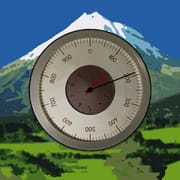
The Android app in question is a highly downloaded altimeter that distinguishes itself by functioning effectively even without an internet connection. This functionality is achieved through the integration of three distinct methods for altitude estimation, ensuring a reliable measurement irrespective of connectivity. These methods include satellite triangulation, which provides a baseline estimation of altitude even in the absence of an internet connection, although it is noted to be slower and somewhat less accurate than other methods. The app also utilizes global topography maps to ascertain the ground elevation at the user's current location. This method enhances accuracy by cross-referencing the user's position with known elevation data. Furthermore, the app leverages the device's pressure sensor, if available, to estimate altitude based on atmospheric pressure. This method is particularly precise when calibrated using pressure data from nearby weather stations, allowing for real-time adjustments and improved accuracy. The app's design prioritizes user accessibility and information clarity. It includes a history chart that allows users to review the elevation gain of their movements, providing a visual representation of their ascent or descent over time. This feature is particularly useful for hikers, climbers, and anyone interested in tracking their vertical progress. Additionally, the app integrates named summits and contour lines on its maps, enabling users to identify geographical features and understand the terrain around them. The ability to select altitude from any point on the map further enhances the app's utility, allowing users to plan routes and assess the elevation of specific locations in advance. The app also offers a feature to overlay altitude and geographical names on photos, making it easy to create visually appealing and informative records of outdoor adventures. This functionality combines practical utility with aesthetic appeal, allowing users to share their experiences in a compelling way. The app’s ability to function offline and provide accurate altitude readings through multiple methods makes it an essential tool for outdoor enthusiasts who venture into areas with limited or no internet connectivity. The integration of historical data, map information, and photo capabilities further enhances its value, making it a comprehensive and user-friendly altimeter for Android devices. The developers have clearly focused on creating a reliable, accurate, and informative tool that caters to a wide range of users, from casual hikers to serious mountaineers.
The pro version of the app unlocks additional features that further enhance its functionality and accuracy. One key feature is the correction of system errors in the pressure sensor, which can significantly improve the reliability of altitude readings. Pressure sensors, while generally accurate, can be affected by various factors, including temperature changes and device calibration issues. The pro version addresses these issues by implementing advanced algorithms that compensate for these errors, ensuring more precise altitude estimations. Another significant enhancement in the pro version is the ability to download larger regions from global topography maps. This feature is particularly useful for users who plan to travel extensively or explore remote areas where detailed map data is not readily available. By downloading larger regions, users can access comprehensive elevation information even without an internet connection, allowing for better route planning and navigation. The pro version also includes the ability to record altitude even when the app is not actively open. This background recording feature is ideal for tracking altitude changes over extended periods, such as during a multi-day hike or a long road trip. The recorded data can be later analyzed to gain insights into elevation profiles and overall vertical progress. The ability to select altitude on the map without restrictions is another valuable feature of the pro version. In the free version, there may be limitations on the number of altitude selections that can be made within a given time period. The pro version removes these restrictions, allowing users to freely explore the map and obtain altitude information for any point of interest. Finally, the pro version eliminates all advertisements, providing a clean and uninterrupted user experience. This is a significant benefit for users who rely on the app frequently and want to avoid distractions. The combination of these features makes the pro version a worthwhile upgrade for serious users who demand the highest levels of accuracy, functionality, and convenience. The ability to correct pressure sensor errors, download larger map regions, record altitude in the background, select altitude without restrictions, and remove advertisements significantly enhances the app's utility and makes it an indispensable tool for outdoor adventures.
In summary, the Android altimeter app offers a robust and reliable solution for measuring altitude, even in the absence of an internet connection. Its key strength lies in its ability to utilize three different methods for altitude estimation: satellite triangulation, global topography maps, and device pressure sensors. This multi-faceted approach ensures accurate readings regardless of connectivity and environmental conditions. The app's user-friendly interface includes features such as a history chart for tracking elevation gain, integrated maps with named summits and contour lines, and the ability to overlay altitude data on photos. These features enhance the app's utility and make it an engaging tool for outdoor enthusiasts. The pro version of the app further enhances its capabilities by correcting pressure sensor errors, allowing for the download of larger map regions, enabling background altitude recording, removing restrictions on map altitude selections, and eliminating advertisements. These enhancements cater to serious users who demand the highest levels of accuracy, functionality, and convenience. Overall, the app provides a comprehensive and reliable solution for altitude measurement, making it an essential tool for hikers, climbers, and anyone interested in tracking their vertical progress. The developers have successfully created a user-friendly and feature-rich app that meets the needs of a wide range of users, from casual hikers to serious mountaineers. The app's ability to function offline and provide accurate altitude readings through multiple methods makes it a standout choice in the crowded market of Android altimeters. The integration of historical data, map information, and photo capabilities further enhances its value, making it a comprehensive and user-friendly altimeter for Android devices. The focus on reliability, accuracy, and user experience makes this app a top contender for anyone in need of a reliable altitude measurement tool on their Android device. Its combination of offline functionality, multiple estimation methods, and pro version enhancements sets it apart from competitors and makes it an indispensable tool for outdoor adventures and other altitude-sensitive activities.


 4.40
4.40
 APK
APK